Date published: 2026-03-17 | Category: Bath, Delivering for local residents, Tackling the climate and ecological emergency
Bath & North East Somerset Council has completed the first phase of works on the ambitious Bath River Line project, marking a significant milestone in creating a 10km linear park that connects Bath’s riverside spaces, improves biodiversity and enhances active travel routes across the city.
The completed improvements have focused on revitalising key areas between Norfolk Crescent and Bath Quays. Green Park now has an all-user resurfaced path, a widened entrance and a new river viewing area and bench; the seating area between Green Park and Sainsbury’s has been improved and will be planted with a rain garden, including climate-resilient planting and pollinator-friendly planting, and path repairs have improved and widened the riverside path outside Norfolk Buildings.
Councillor Paul Roper, Cabinet Member for Economic & Cultural Sustainable Development, said: “Bath River Line is already transforming how people experience and move through our city. These improvements are helping to unlock the full potential of the river corridor by creating safe, attractive and connected spaces that support active travel, boost biodiversity and celebrate Bath’s unique heritage.
“A further £600,000 in grant funding from the West of England Mayoral Combined Authority, awarded in January 2026, is a welcome endorsement of the project’s value. I’m pleased to see the next phase now starting, so we can continue this momentum. I want to thank our partners, local organisations and volunteers whose contributions have been vital in bringing this vision to life.”
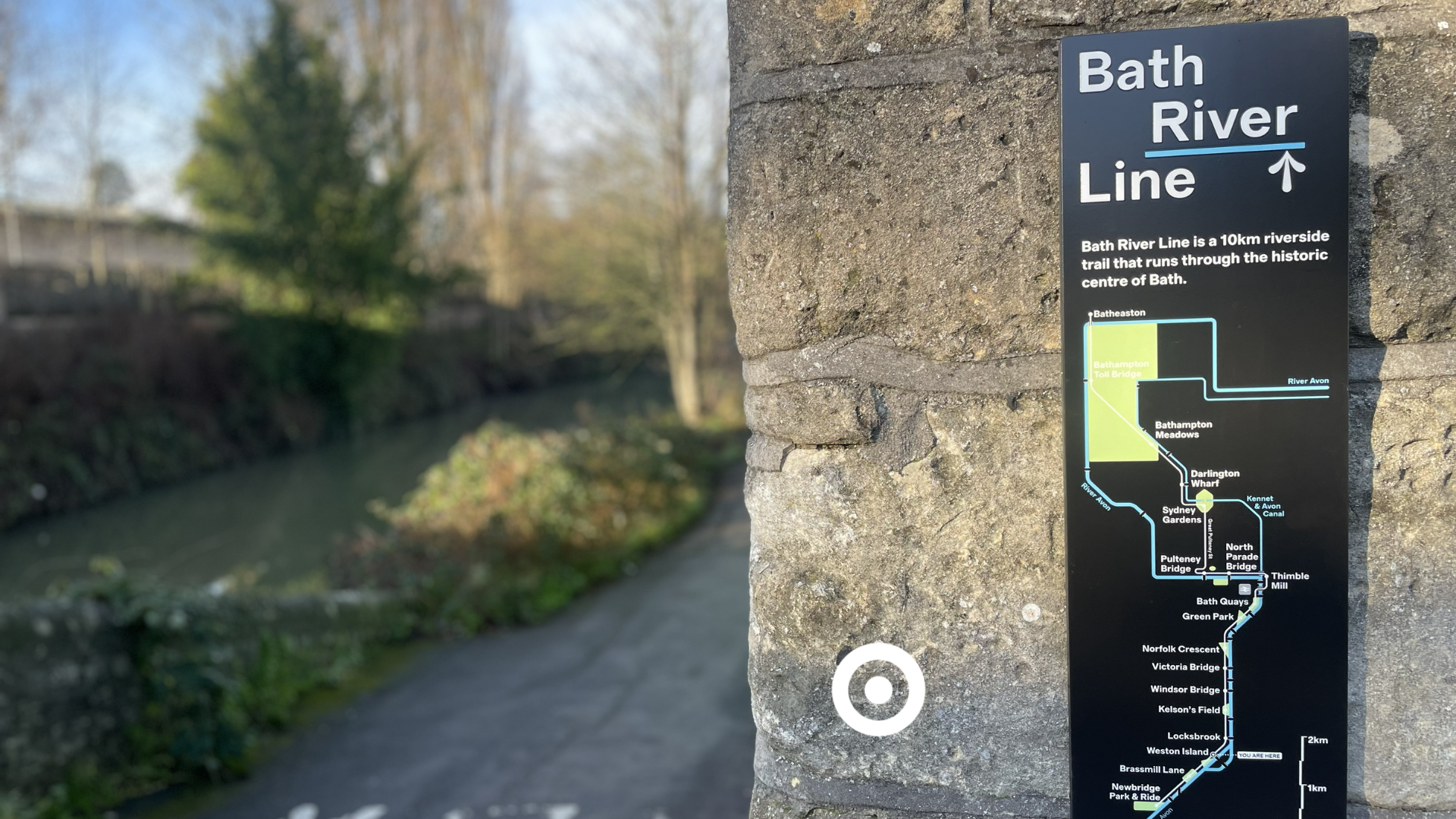
A major element of the initial phase has been the installation of new wayfinding signage and interpretation boards, helping to create a connected and engaging riverside experience. The interpretation boards feature 21 stories about Bath’s riverside history, nature and culture and have been developed collaboratively with council teams and local organisations.
They feature nature illustrations by local artist Marian Hill and historic images from the Royal United Hospital, Bath Royal Literary and Scientific Institution, Miller Knoll, and Bath In Time, alongside research carried out by the late Mike Chapman, including a recreated map of the Lost Streams of Bath.
Seventeen organisations, including the World Heritage Steering Group, Environment Agency, and Bath Industrial Heritage Trust, contributed to shaping the interpretation text and information and site preparation for installations was generously supported by WaterSpace volunteers.
The new signage was designed by Fieldwork Facility, to help residents and visitors navigate the route, and engineered and installed by Rivermeade.
Works will continue throughout the year and include an upgrade to the play and seating area at Green Park. Details of specific works will be shared with residents ahead of any on-site activity, and signage will be used along the route to explain upcoming changes. The path will remain open wherever possible.
The works support the council’s vision to expand the active travel network, improve the quality of the towpath and surrounding green spaces, and create a more visible, biodiverse, accessible and enjoyable riverside for residents and visitors.
You can find more information on the Bath River Line project on our website.
ENDS